
Harnessing the Power of Space in Agriculture: In today’s world, all sectors of our lives are striving to optimize production processes. We want to get the maximum benefit with the minimum investment. In the agricultural industry, the introduction of so-called “precision farming” is a tool to increase the efficiency of all stages of production.
The concept of precision farming involves the use of various technologies, including remote sensing, to reduce labor and material costs while increasing the quality and quantity of products. With the availability of space data and the development of new AI algorithms for it’s fast and smart analysis, satellite images have become an integral part of agriculture and will continue to spread its use worldwide. We’ve gathered some of the main examples of how exactly satellites cater to farming and increase its efficiency.
Table of Contents
Agro Monitoring
One of the areas where space technology is actively used is agriculture. Thanks to the latest technology developments, like artificial intelligence and high-precision satellite data, farmers can see what is happening on the field online, receiving notifications about the state of crops, weather conditions in the region, and recommendations for improving the crop health.
Such ag monitoring powered by space data expands opportunities not only for agricultural holdings and farmers working in the field directly. Satellite analytics helps traders build price forecasts, allows lenders and insurance agents to determine rates directly from the office, and allows the state to manage land assets.
The use of space monitoring technologies makes it possible to estimate the area of crops with high accuracy, track the condition of plants in all phases of growth, predict crops in the early stages, control agricultural operations, etc.
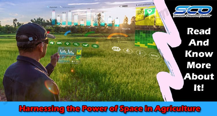
The essence of farm monitoring with the help of space technology is the analysis of the state of crops based on the results of satellite images. Flying over a certain area and taking high-resolution pictures, the satellite captures fields carrying out the shooting in several spectral ranges. To process and interpret images, spectral indices are used, which take into account various factors like cloudiness, shadows, site topography, different angles of incidence of sunlight, the difference in the shooting angle, and the influence of the environment. The resulting images are a source of operational information about crops, as special spectral cameras allow farmers to use vegetation indices (NDVI, NDRI, RVI, etc.). Spectral reflectivity is individual for each crop and differs in the specificity of the reflection of different wavelengths. Knowing the reflectivity of a plant, it is possible to identify it and evaluate its condition on spectral images. The results of satellite monitoring are:
- Obtaining operational information over the entire area to identify problem areas of the field
- Assessment of crop state
- Identification of crop type
- Determination of biomass growth dynamics
- Timely detection of changes.
Processing of multispectral images makes it possible to learn about nitrogen deficiency and the need to apply fertilizers and plant protection products in specific parts of the field. It will also help to learn about the degree of ripening of the crop and predict the yield.
Yield Forecasting
Forecasting crop yields in developing countries helps agriculture by preventing famine and improving food security. However, existing forecasting methods are expensive and difficult to scale because they require locally collected data. Approaches using remote sensing data, such as satellite imagery, have the potential to provide a cheap and efficient alternative. Space data powered software can store information on the date of germination, crop health, historical data on the field through years, and help predict the possible yield.
Crop Acreage Estimation
An important task is to keep the field data up to date. Over time, field boundaries change, so it is necessary to periodically adjust them so that they correspond to the actual cultivated areas. It is possible to understand that the field needs to be corrected according to the field work tracks (when using equipment monitoring systems), or by re-measuring the fields using one of the software that leverages satellite data.
Drought and Flood Monitoring
Agriculture, being a climate-sensitive industry, is adversely affected by natural disasters that can damage or destroy equipment and cause significant damage to crops. Farming is most affected by droughts and floods. Extreme heat, drought, and floods lead to unpredictable yield changes. This situation is likely to continue in the future, and farmers, both small and large, are trying to increase irrigation efficiency, find ways to retain moisture in the soil and harvest faster. And this is where space technology comes in handy, offering precise data on the local conditions via different software to enable farmers to predict the drought and flood threats and make smart decisions to avoid them or mitigate their impact.